Navigational Instruments
Explain how Europe benefited from cultural diffusion during the period c. A.D. 1000 - 1500.
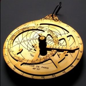
Astrolabe

The astrolabe is a historical astronomical instrument used by classical astronomers, navigators, and astrologers. Its many uses included locating and predicting the positions of the Sun, Moon, planets and stars; determining local time given local longitude and vice-versa; surveying; and triangulation.
Throughout antiquity, the Greeks and Arabs steadily advanced the science of astronomy and the art of astrology. About a thousand years ago, in the 10th century, Arabs introduced Europe to two important astronomical instruments - the quadrant and the astrolabe.
In the Islamic world, they were used primarily for astronomical studies, though astrology was often involved there as well. Astrologers of the European nations used astrolabes to construct horoscopes.
There is often confusion between the astrolabe and the mariner's astrolabe. While the astrolabe could be useful for determining latitude on land, it was an awkward instrument for use on the heaving deck of a ship or in wind. The mariner's astrolabe was developed to address these issues.
In the word astrolabe
- astro
means star and labe
roughly translates as to take or to find. The astronomer's beautiful,
intricate and expensive astrolabe was the grandfather of the much simpler, easy to use mariner's
quadrant.
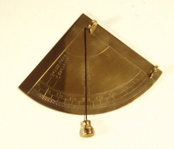
Mariner's Quadrant

The mariner's quadrant - a quarter of a circle made of wood or brass - came into widespread use for navigation around 1450, though its use can be traced back at least to the 1200s.
The quadrant was a popular instrument with Portuguese explorers. Columbus would have marked the observed altitude of Polaris (the North Star) with a quadrant at selected ports of call.
Alternatively, the navigator could record the altura, or altitude, of Polaris quantitatively in degrees at Lisbon and at other ports to which he might wish to return. It was not long before lists of the alturas of many ports were published to guide the seafarer up and down the coasts of Europe and Africa.
During the 1400's, Portuguese explorers were traveling south along the coast of Africa searching for a route to the Orient. As a seafarer nears the equator heading south, Polaris disappears below the horizon. So, in southern seas, mariners had to have a different way of finding their latitude.
Under orders from the Portuguese Prince Henry, The Navigator, by 1480, Portuguese astronomers had figured out how to determine
latitude using the position of the sun as it moved north and south of the equator with the seasons, what we now call its declination.
In simple terms, the navigator could determine his altura, his latitude, by using his quadrant to take the altitude of the sun as it came to its greatest altitude at local apparent noon, and then making a simple correction for the position of the sun north or south of the equator according to the date.
The mariner's quadrant was a major conceptual step forward in seagoing celestial navigation. The quadrant provided a measure in degrees of the altitude of Polaris or the sun, and related this number to a geographic position - the latitude - on the earth's surface.
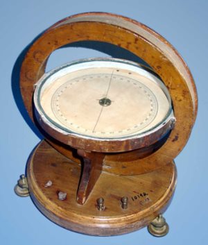
Magnetic Compass

A compass (or mariner's compass) is a navigational instrument for finding directions on the Earth. It consists of a magnetized pointer free to align itself accurately with Earth's magnetic field, which is of great assistance in navigation. The face of the compass generally highlights the cardinal points of north, south, east and west.
A compass can be used in conjunction with a marine chronometer (invented mid - 18th century) to calculate longitude and a sextant (invented early - 18th century) to calculate latitude, providing a very accurate navigation capability. This device greatly improved maritime trade by making travel safer and more efficient.
An early form of the compass was invented in China in the 11th century. The familiar mariner's compass was invented in Europe around 1300, from whence later originated the liquid compass and the gyrocompass.
