Geographic Knowledge

Explain how Europe benefited from cultural diffusion during the period c. A.D. 1000 - 1500.
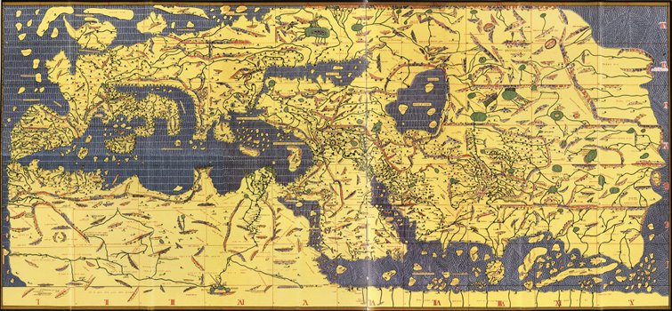
The Tabula Rogeriana, shown here upside-down, drawn by Muhammad al-Idrisi for Roger II of Sicily in 1154. The map, written in Arabic, shows the Eurasian continent in its entirety, but only shows the northern part of the African continent. The map is actually oriented with the North at the bottom. It remained the most accurate world map for the next three centuries.
A field that interested Islamic scholars of the Middle Ages was geography.
The first steps had been taken in the East, when books of routes
, as they were called, were compiled for the use of the
postmasters of the early Abbasid caliphs.
Soon, reports on faraway lands, their commercial products and major physical features were compiled for the information of the caliph and his ministers. Advances in astronomy and mathematics made the plotting of this information on maps feasible, and soon cartography became an important discipline in its own right.
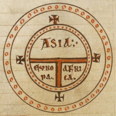
A T-O Map from a 12th century copy of Etymologiae.
Muslims translated many of the Hellenistic documents. The way in which earlier knowledge reached Muslim scholars is crucial. For example, since Muslims inherited Greek writings directly without the influence of the Latin west, T-O maps play no role in Islamic cartography though popular in the European counterpart.
Some of the important Greek writings include the Almagest and the Geographia. Muslim scientists then made many of their own contributions to geography and the earth sciences.
The Arab geographer, Muhammad al-Idrisi, produced his medieval map Tabula Rogeriana in 1154. He incorporated the knowledge of Africa, the Indian Ocean and the Far East gathered by Arab merchants and explorers with the information inherited from the classical geographers to create the most accurate map of the world up until his time and remained so for three centuries afterwards.
The works of al-Idrisi include Nozhat al-mushtaq fi ikhtiraq al-afaq
, a compendium of the geographic and sociologic knowledge
of his time as well as descriptions of his own travels illustrated with over seventy maps.
He created kharitat al-`alam al-ma`mour min al-ard
(Map of the inhabited regions of the earth) wherein he divided the world into 7 regions, the first extending from the equator to
23 degrees latitude, and the seventh being from 54 to 63 degrees followed by a region uninhabitable due to cold and snow.
al-Idrisi firmly believed that the earth was spherical and constructed a world globe map of 400 kg pure silver and precisely recorded on it trade routes, lakes and rivers, major cities, and plains and mountains.
In his book, Geografia, he even described the large seafaring Chinese junks of the Song Dynasty, the ports of call they came to in the Indian Ocean, and the usual goods aboard their ships.
Geografia is not a perfect historical source, as al-Idrisi (as was common then and for many more centuries) relied on other sources for it.
For example, when writing about Poland he has conflated it with the land that is the modern-day Czech Republic, because he wrote about a country surrounded by mountains
.
al-Idrisi's world maps were used in Europe for centuries to come. They were used extensively during the European Age of Explorations and modified versions were even used by Christopher Columbus.